Showing posts with label Tevis. Show all posts

Sunday, December 4, 2016

Plans (with a small p) for 2017

It's that time of year again, when energy levels are so low that you can't actually accomplish anything, so spend your time planning things you could accomplish if perchance that enthusiasm should return.

During my daily mucking sessions (when I do my best thinking), I was musing on the regular thought that none of us are getting any younger. Roo will be 17 during this coming ride season, Uno and Hopi 16, with Fergus being 15. Small Thing brings up the rear at 12. Having extra horses is my insurance for when the current Worker Bee gets broken. This only works, of course, when they do break, and thankfully we haven't been in that position recently, so I have the dubious pleasure of having more horses than time to ride, so have to prioritize. This is the plan for this year:

Roo - Decade Team

Other than getting a single 50 on Roo this coming season to officially cement our Decade Team standing, I don't have any big goals for him.

The plan is to to take both him and Fergus to NV Derby and do both days since it was so much fun last time (not)(fun times juggling screaming horses during vet checks in camp).

To get him fit I suspect much of his conditioning will be at the end of a lead rope, as I prepare Fergus for his first ride of the year at 20MT, but it has worked before and is fun to take both of them out as a gang.

Small Thing - Tahoe Rim Ride 

Thursday afternoon, I got the news that Small Thing and I had a place in the Tahoe Rim Ride at the end of next August. I've done this ride three times (on Roo - it's his best ride), crewed/volunteered twice, and figured it would be an excellent trail for Small Thing - tight and twisty with very few "big trot" sections ("big trot" being something he doesn't really have in his repertoire). This does mean I've got my work cut out for us, getting him ready, and I have no idea if he's capable of 50 miles - the furthest we've ever gone is 21 miles on the CA Loop - but it's this sort of push that I need to actually do something constructive with him, instead of putzing around.

Fergus - 100s

As always, Fergus forms the core of my endurance goals. Having him means I can pick things I want to do, rather than having to limit the goal to the horse's capability. Of course I'll willingly do that if necessary - see above - but the freedom of being able to chose what I want to do is something cherished and never taken for granted. Fergus is such an outstanding horse and with our time clock ticking, I want to do as much with him while I still can.

What has always excited me the most is doing 100s, so that's a big part of next year's plan with four 100s scheduled.

A fun thing to do at the beginning of the year is see what's available and see how it fits together - and it looks like the rides I hope to do with Fergus slot together beautifully, giving him plenty of time between each one:
  • 25 February - 20 Mule Team 100
    (5 weeks)
  • April 1 - NV Derby - Fergus
  • April 2 - NV Derby - Roo
    (5 weeks)
  • 6 May - Duzen Doozie 100
    (5 weeks)
  • 10 June - NASTR 75
    (4 weeks)
  • 7-8 July - Tevis Educational Ride - Fergus as a Mentor?
    (4 weeks)
  • 5 August - Tevis
    (3 weeks - Tahoe Rim with Small Thing)
    (6 weeks)
  • 16 September - Virginia City 100 (and hopefully a Triple Crown Completion)


Thursday, May 12, 2016

Eurolite Fitting Update

So my Endurance Plan this year is going about as well as my Endurance Plan went in the second half of last year, that's to say, not swimmingly ... i.e. we haven't managed a single ride yet this year. I'll admit to feeling heightened anxiety (read "mild panic") at this point akin to a newbie who's never done any rides. I don't feel ready, I don't feel my horses are ready, I don't feel our equipment fits, I'm not fit enough, etc, etc...

Part of the problem has been trying to work out saddle fit for Fergus. After spending the first few months of the year trying out various saddles, finding some that worked for him, but not for me, I finally settled on a Specialized Eurolite. As someone warned me, they are good saddles - once you get them dialled in for the horse. ...And we're still at the "getting it dialled in" stage. We're close, but given our past saddle fit problems, I'm super-picky.

This weekend, after about 14 miles, I finally felt like I'd just about got the saddle to where it needed to be for me, but found some interesting sore spots on my undercarriage today. To say I mourn the use of my Sensation* would be an understatement.

(* I'm still using it on Roo and Uno, so get to be reminded of its loveliness at regular intervals).

The nice thing about the Eurolite is the removable seat. A saddle fitter helped me by showing me just what could be done in terms of making it more comfortable for me. As a result, I now have more of a twist in the seat than I ever felt would be possible thanks to the creative use of a Sensation pommel bolster and some carefully positioned Specialized shims:


Pommel bolster + shims to add twist and make the seat work for me


She also showed me how to make knee rolls - which I needed, not being used to free-swing stirrups or lack of pommel to brace against on steep downhills.


Knee rolls. Look bodged, work great.


All these items were hidden under my trusty sheepskin... until I rode a few times and discovered that either my bum is too big, or (more likely, of course), I have a long femur (grasping at straws), resulting in feeling like the seat is too small and falling out the back of it. As it turns out, the Eurolite is a 15", my Sensation is a 15.5", and the UltraLite I demoed (which felt HUGE) was a 16". Of course.

So I sadly ditched the sheepskin cover, and proceeded to rip the crotch and knee out of a (thankfully old) pair of tights on the exposed hook-velcro on the shims on two short rides. Hmmm.

Found a few scraps of purple fleece and used them to wrap around the hook-velcro, and, voila, properly cushioned shims. Except that the purple is... well, purple, and doesn't really match anything else. I shall try to find some non-purple scraps of stretch fleece.


This was the latest in shimming on the underside for Fergus, plus widening the cushions in back to flip the front up more:

Fergus is fairly flat-backed, so needed some shims to offset the rock in the tree

we rasped down the center area of the cushions to give him more space in his bulgy areas closer to his spine
...and the latest mod was widening the area between the cushions just in the back to try and alleviate some pressure in front.

The above shimming/cushion placement still resulted in this odd ruffled area (between my fingers) after 17 miles, but it was somewhat improved compared to earlier setups:


As an experiment, on our morning quickie 3-mile blast up the lane and back, I added more shoulder shims, thinking that the offending area is just behind the pommel area on the tree, but that resulted in completely dry areas, so nix that. Apparently it's the shoulder area that is acting funky.

We're off to the Tevis Fun Ride tomorrow, so hopefully Brenda Benkly will be able to take a look at it and offer some advice on what else I can do.


Of course, predictably, this week I've decided that if I find a 16" Eurolite, I will grab it, so might end up going through this whole thing again, unless the tree turns out to be the same. Right now I can work with what I've got, but I don't love it. 

Ten weeks until Tevis. Fergus is, at this point, less than enthusiastic, but I suspect that might be because we've been training solo all year and he's lonely. We shall see how he feels this weekend in company and if he seems better, my entry will go in the mail. 

Monday, January 18, 2016

2015... in Review

Looking back on the year, it felt somewhat disjointed and out of sorts. But despite some missed goals and disappointments, I realise that I rode in some absolutely amazing locations and continue to appreciate just how lucky I am to live in such a lovely area.

We had our ups and downs, but finished the year on an up with ailments either diagnosed or at least on the mend, and starting 2016 positively.


January:

This month marked the driest year since records began in 1877 for our area - the whole state was in trouble, and our lovely dry winter - whilst good for horse conditioning - did little for the parched reservoirs that were dropping to record low levels (for example, Folsom Lake, one of our closest, was at 15% capacity by December).

Over Christmas/New Year, pft and I made our usual trip south to the desert and went horse camping at Catalina State Park down near Tucson, AZ. pft wasn't riding horses, so we only took Fergus and bicycles. It snowed and we froze our butts off, but had a good time nevertheless. The scenery is so gorgeous down there - and best of all, it was slop-free. Ash drove over for the day and we spent a happy afternoon walking deckers in the snow.

I love it there, but the two-day drive to get there is definitely a damper.

Catalina State Park, near Tucson, AZ

Later that month, the horrible Charlie Hebdo shooting occurred, raising many questions in my mind about freedom of speech and ramifications thereof.

20 Mule Team 100 was on the calendar and I decided to give myself some "just in case" insurance by getting both Roo and Fergus fit for 100 miles. I ponied Roo off Fergus at high speeds (gosh, his legs can extend - something I wouldn't in a million years let him do under saddle), and had fun having them both along.

In the knitting department, I churned out this excellent star beret in one weekend. Love it to bits, but it's hard to wear because I'm never quite sure how to put it on:

Star beret


February:

Sally came to visit and we took Roo and Fergus out on the high trail for an afternoon of speed work. This was yet another time when Roo went out under saddle but I wasn't on him - which was a recurring theme throughout this year.

Most people have sporting heroes and mine is musher Brent Sass. Brent has the best approach of anyone I know - his motto being "Attitude is Everything" - doing his utmost to make the best of even the worse situations. Last year he came so close to winning the 1000-mile Yukon Quest before flipping off the back of the sled in a moment of exhaustion and giving himself concussion. This year he was back again, wearing a helmet buried under his layers of hats. Figuring out a helmet that is going to work in -60°F/-51°C took some doing, but it paid off and he won - despite oversleeping on the trail by several hours towards the end of the race, causing his followers to have minor panic attack and think that, once again, "something bad" had happened. It ultimately provided a nail-bitingly close finish, with many hours of hitting <refresh> <refresh> <refresh> following the tracker - and he finally won, beating the 2013-2014 champion Allen Moore.

At the end of the month, Fergus, Spike and I headed south for 20 Mule Team 100. We rode with Kaity and had a lovely time in what turned out to be one of the best spring flower displays in years. Kaity's mom, Carol, crewed for us and took care of Spike for the day - for which I am mightily grateful.

20 Mule Team, near Ridgecrest, CA


March:

After two and half years, I got my braces off! And felt like I had a mouth of someone else's shiny plastic teeth.

The AERC Convention was a fun weekend - at dinner there were four decker-owners in a row... and mine was the only one who (news from home) had TPed the back deck. I came home minus all my sweaters and jackets and had to contact the hotel's lost and found - thank goodness I have friends in Reno who could go and retrieve them. Lastly, I did my homework and filled out eight (count 'em) 100 mile surveys that I'd promised the AERC research vet, Olin Balch.

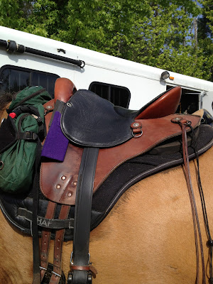
Inspired by the Adhere guy at the convention, Fergus and I embarked upon a search for squishy feet inside his boots to give him more concussion protection. This proved curiously prophetic later in the year.

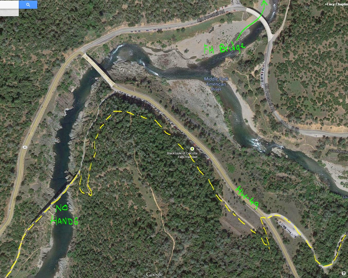
Uno got ridden (something that needs to happen more often) at Cronin and Roo and I took to the Larimer Trail in hot and humid conditions (and, bravely, in an S-hack... not the best choice for him) and got chronically lost on the way home exploring the area behind Larkin's.

Larimer Trail high above the Middle Fork of American River, looking down on the River Road used on Tevis


April:

Fergus, Roo, and I headed for a weekend of 50s at NV Derby. Luckily I parked at the end of the trot-out lanes, because whenever we got back to camp, the horse left behind screamed incessantly, necessitating fetching it and taking two horses through the vet check. I opted to let Fergus out a little "to see what he could do" - and the result was a 25th place finish in a field of 72 - but an "I see something on the left front" from the vet at the finish (we completed, but it was there).

(Coupled with an "I see something" at the first vet check at 20MT - it was enough to make a girl nervous that something was brewing ...but predictably not loudly enough to tamper my enthusiasm).

The next day Roo got a top-ten finish tagging along behind Connie and Dave. Although in a field of only 21 starters it was a slightly less spectacular result, I still felt like I worked hard.

Snow that afternoon meant that I couldn't get home, so I spent a frigid, blustery night camped out alone at Washoe Valley (pones bundled in their blankies) before driving back over the mountain on Monday morning when it cleared - on an absolutely crystal clear morning of crisp white snow. Gorgeous.

Fergus, overachieving at NV Derby
Photos Gore/Baylor
Roo holding his own and getting his first top-ten


Towards the end of the month, there was a horrific 7.8 Earthquake in Nepal - lots of destruction in the country and a nasty avalanche at Everest Base Camp. That put paid to the climbing season for the second year in a row.

With our success at 20MT, I decided that Fergus and I would make the trek to Wyoming to do the Big Horn 100. With lots of climbs to get ready for, we spent a good few mornings climbing the Powerlines at the end of the lane.


May:

The whole family (well, pft, Finn, Spike, me, n' Roo) went to the High Desert ride over in NV. I'd never done it before and we were to chaperone friend Dionne on her horse Storm's first 50. It was exactly what was needed - a nice relaxed easy-going 50... pouring rain the day before notwithstanding:


High Desert, near Stillwater, NV.
Roo wondering about the thunder clouds, Storm trying to pretend she can't see them.


Another first - pft took me to the drive-in to see "Thor" for my birthday.

To get our second part of the Triple Crown, Fergus and I went to NASTR 75. Inspired by his performance at NV Derby, I once again let him move out - we were even leading the ride at one point, much to my embarrassment - with the predictable result that he went lame at 60 miles. <slap forehead>

Although interesting and educational, playing "top ten" wasn't remotely enjoyable and won't be happening again - not least because letting 1200 lb horses run on hard dirt tracks is not conducive to good health. A subsequent visit to the vet on Monday produced a "sore feet" diagnosis (I had been resigned to a suspensory injury at best, so this diagnosis was met with some degree of disbelief) and I consequently made the decision to move to slightly beefier Renegade boots for better concussion protection.


Despite the vet thinking Fergus'd be OK for Big Horn 100, I wasn't much enthused by the idea - I always prefer to give a good break after any injury, and didn't think that travelling 2000 miles round trip on a "he'll probably be OK" gamble was a great idea, so our Big Horn plans fell off the calendar.

Finally, after many years of good service, my Miata let me down by nearly not making it to work one morning. We got trucked home, courtesy of US Rider, and the problem was deemed a faulty ignition system. Couple that with being about 100,000 mile past needing a timing belt change, Miata has been moved to the garage for some TLC.


June:

June 5th marked the real start of summer with the annual erection of the back deck sunshade (this year tied to a tree, rather than a cinder block - high tech).

With a visit from friends in England who we'd promised to take camping looming on the horizon, we took a trip up to Faith Valley to reccy the situation. pft mtn biked, the dogs romped, and I rode Small Thing (who managed to kick Spike in the chin on purpose, dampening the fun day). Love it up there.


Faith Valley - across the meadow


Faith Valley - evening quickie on our day of arrival


While we were there, pft got a puncture and Small Thing ended up tied to a tree - no big deal. But he then had a small meltdown when he got his leg over the lead rope - not usual for him who normally sees such things as minor inconveniences. Once we got home, I figured out why - it looked like he'd gotten his legs caught in the fence a few days before we left without me realising. As a result, the fence at the bottom of his paddock wasn't as good as it had been and needed replacing - particularly as that would be Kaity's horse Ani's paddock during Tevis week, so pft and I spent a happy weekend scrabbling in the dirt, pulling out the old (now long-buried) fence and replacing it with new.

Spike n' me do fencing


Knowing this year I wasn't going to ride Tevis, as soon as it got vaguely hot, I shamelessly cranked up the a/c in the car and drove to work in the nice cool. I'll take the little pleasures as needed.

At the end of the month, I spectated the WS100 run - this year giving impromptu help crewing for a runner from the East Coast. As always, in awe of the runners - and enjoyed spending the day in Foresthill and the evening down at the river crossing.


July:

This month saw us cram in as much as we possibly could.

We took the dogs and mountain bikes to Utah, camping - and had one of our best trips to date. Starting at the Wedge - the scenery was amazing, the place deserted (excitement and interest whenever we saw a car off in the distance), and we had a fun time mtn biking the Good Water Rim Trail... a LOT.


Good Water Rim Trail - most amazing, unexpected scenery 

Good Water Rim Trail, a quarter mile from our camp

We spent the second half of our trip at San Rafael Swell, behind the reef, visiting Wild Horse Window cave, Goblin Valley during a spectacular thunderstorm, and finishing up with a hike through the slot canyons of Little Wild Horse Canyon.

Our camp "behind the reef", San Rafael Swell

Wild Horse Window cave

Goblin Valley

Goblin Valley

Little Wild Horse Canyon

Little Wild Horse Canyon


We were then home for a week, before setting off once more to Faith Valley to set up for the Kind family's camping trip. We had a fun weekend, mtn biking, horse riding (not as successful as hoped, but we were able to salvage some rides out of it), and ending with a trip for pft, Dave, Elliott, and Austin to the Flume Trail on mtn bikes/running.

Small Thing disgraced himself at Faith Valley, but to be fair I put him in a bad situation so take full responsibility for my own stupidity. Unfortunately, however, his behaviour filled his imaginary jar almost to the brim with black balls and it would be Christmas time before we got everything back under control.

Finally it was Tevis week ...


August:

...This year it was Kaity and Ani competing, and Ash, Carol, me and Renee crewing. We got her in, we got her out, and as a team we did a great job. High Five Us! ...Oh, and Kaity and Ani finished on target, so I guess they did good too ;)

After meeting sisters Ali and Jessica at Faith Valley, once we were home, we hooked up and did some fun conditioning rides with Ali on Roo. Although he did plenty of conditioning this year, most of it was either on the end of a lead rope, or with someone else in the saddle. We had plans this month for Bridgeport - Fergus one day to get him ready for VC100 in September, Roo the other; followed by Tahoe Rim - Roo's favorite - to ramp him up for the Riding Dead 100 at the end of October.

Well, best laid plans... Bridgeport was cancelled due to a wild fire, so I ended up having to take Fergus to Tahoe Rim out of necessity. The ride went well but I came out of it in poor shape - mostly from holding him back all day, as well as muscling him around that tight course. My ducks weren't in a row ready for VC100, but I thought I could pull it together in the next three weeks.

Early one morning Finn was out on the back deck barking at squirrels... and continued to bark and bark and bark. Finally pft went out to check — only to see a bear about 50 feet from the back of the house. Oh.

I made some feeble attempts at putting white balls in the ST's jar - not with great success when we once again ended up with him rearing and me yelling. Needs work. I persevered (mostly by avoiding the horses running the fence) and got a couple of shorty rides in, but not with any degree of confidence.

Early in the month pft thought he'd pulled a stomach muscle which gradually got worse over time. The Dr thought it might be a hernia, so he started undergoing various tests to figure out what was going on.

My mumma said she was tired of knitting for babies and I talked her in to knitting me a cardi. When it showed up, I loved it.

My lovely cardi


September:

The exciting "moment" for this month was me attempting to trim Hopi in the breezeway of the barn, him having a minor flip out, which escalated in to bigger flip out, followed by me leaping into the hay shed to get out of his way - and him following me into that tiny space. Awk. We managed to get out of the situation unscathed, but it was one of those "life flashing before your eyes" moments.

In a continued effort to get Fergus in better shape for VC100, I had Tom Mayes come out and work on him with some eye-opening results. What I thought was a developing "hunter's bump" turned out to be muscle atrophy on his rump cause by him being jammed up all the way to his shoulder (might explain some of the back atrophy also). Tom suspected that he may have ran into something with his shoulder at some stage and had been carrying this problem around for a while. He also had some similar blocking to his innards, which possibly contributed to my vague impression of his "failure to thrive" this year - it was hard to keep him in good weight. I hoped that this bodywork would help him feel a little better.

pft's health issues continued with a sleep study to see what his apnea might be doing, along with some chiro work to try and relieve his stomach/muscle/back problems. Neither was terribly conclusive.

Our final conditioning rides for VC100 were cancelled due to smoke from the Butte Fire about 35 miles south of us. This fire, which burned enthusiastically for a couple of weeks, ended up consuming 475 houses, 343 outbuildings, 71,000 acres and killing two.

We were well socked in with smoke, raw throats from breathing the air particles, and things were so tinder dry we were living in daily dread over the possibility of any fires starting.

Smoke from the Butte Fire at home

On Saturday 12th, we watched in horror as footage unfolded of what was to become the Valley Fire - strong winds blew what should have been a minor incident into an inferno in a matter of minutes, injuring firefighters and ultimately growing to 50,000 acres in 24 hours. That fire topped out at 76,000 acres, with four deaths, and burned most of the towns of Middletown, Cobb and surrounding communities - 1958 structures burned.

On Sunday 13th, a small fire started a few miles from us and although I could hear the air tankers to the north of us, I couldn't see them in the already thick smoke. They got the fire out quickly and it turned out to be an arson/triple homicide.

It was not a good month for fires.

VC100 happened on 19th - and I think I was already sufficiently unsettled that it just didn't seem to go well, despite Fergus having an outstanding day on paper. I came home exhausted and dreading the fact that I needed to "go again" to get Roo ready for the Riding Dead 100 at the end of October. I knew I'd have fun once we were there, but my heart really wasn't into the commitment needed to get him ready, so although I was bummed when the ride was ultimately cancelled, I was actually secretly relieved.

Poor Roo - Bridgeport cancelled, replaced by Fergus for Tahoe Rim, and RD100 cancelled. My goal to get him to 2000 miles this year was slipping away, despite only needing a couple more 50s to get us there.


October:

"Winter" arrived on October 1st with me having to put socks on for the first time in months. Always a sad day when you have to put away your Tevas.

October turned out to be what I needed - play with no pressure.

The weather held and pft and I (in shorts, natch) took the dogs for a day trip playing in the South Yuba River at Big Bend near Rainbow Lodge just off I-80. Finn got car sick on the way up there, but once we arrived we all had good fun playing on the rocks. Spike amazed us by falling in the river but not caring one jot - swimming across and then swimming back again (this was after he was too wussy to cross the small creek at Faith Valley). He was fearless leaping from rock to rock (and falling in occasionally, before bobbing back to the surface again, legs scrabbling), while Finn was cautiously reticent.


South Yuba River near Rainbow Lodge

Family photo, South Yuba River near Rainbow Lodge

Because of being slammed at work, and being burned out after Virginia City 100, all I wanted to do this month was explore new trails and ride short distances - I was done with coming home exhausted. Erin and I drove up to Silver Fork (between 50 and 88) and explored the trails - climbing up over the ridge between Caples Creek and Silver Fork. The Silver Fork canyon is quite something to see and Roo was in an excellent mood. It was a good relaxing day.

On the ridge dividing Caples Creek and Silver Fork of American River (photos Erin Riley)

Roo snorkeling in Caples Creek


The next weekend Roo and I drove up to Donner Summit on our own and explored the PCT south of I-80 - from New Donner Summit to Old Donner Summit. Such fun technical trails, with no-one to please but ourselves, we had the best time. It seems like I never get up on these trails until late in the year - and then only have a short window before the weather turns to play up there.

Donner Lake from Old Donner Summit

For the final weekend of October, neighbour Becky and I trailered back up to Donner Summit and this time took the 15 mile Castle Peak Loop north of I-80. It had snowed the night before, so we were squeaking in under the wire. Most of this trail is up above 8000 ft, so once the weather turns, you're done until late June at best. I was feeling a little pressure that Roo needed to be ready for two days at Gold Rush Shuffle in November to meet my goal of getting him to 2000 miles. He was fit, but we hadn't done a lot of mileage or long trotting. I hoped that the over-abundance of muscle-using rocks, not to mention the climbs, would set Roo up. 


Although I knew we wouldn't be going fast, I hoped the amount of climbing and the degree of difficulty would give Roo an all-over workout to get him ready for two days at Gold Rush Shuffle in November. (photo Becky Batson)

Back side of the basin behind Castle Peak (photo Becky Batson)

Front side of Castle Peak, looking down on Round Valley towards the Peter Grubb hut (photo Becky Batson)


November:

Dionne and I did a last conditioning ride from Twin Rocks to the Auburn Overlook in the middle of the month. Roo did well and was quite cheerful the entire ride.

I hadn't ridden there in years and although I knew Folsom Lake was "low", I was quite unprepared for the complete absence of lake - and the resulting rock-pile covered moonscape. Very cool landscape to see. The sandy "lakeside" trail was also something I hadn't ridden on before and I made a mental note to ride there again when a) I needed sand work and b) when El Niño hits and everywhere else is sloppy.

My plan for Gold Rush Shuffle was to do two x 50s with Roo to get him to his lifetime mileage of 2000 miles this year. Dionne and I were going to ride together with Roo in chaperone position to be a calming influence.

I hadn't gotten a chance to trim up Roo's feet before the ride, so ended up doing it the day before which I think was a mistake - I trimmed him too short and right from the start of the ride he seemed very subdued. This was ideal for Storm who was quite excited by the whole proceedings, but he didn't get any more enthused at time went on. By about mile 40 I wasn't sure we were even going to finish the ride at all, as he'd lost all impetus.

Having ridden the 55 there last year and gotten caught out in the dark, I still had PTSD from the experience, but this year the trail in the dark was well-marked with glow-sticks, Roo cheered up towards the end and got his completion, despite being a little off. We were given the option of a recheck to start the following morning, but knowing how he felt, I was almost certain we would not be riding the second day. Sure enough, a recheck wasn't necessary - he was still stiff and not moving freely the next morning, so that was the end of our season - finishing up 15 miles short of our 2000 mile goal.

So all in all, a mixed year, endurance-wise. I made a bunch of stupid mistakes that didn't do Roo or Fergus any good and although we had some good results, my impression of the year was one of disjointedness - rides cancelled, rearrangement of plans, and uncertainties that went with it. You live and learn.

On the health front, I finally got fed up with the tendinitis in my left elbow and went and got some physical therapy. The wussy arm started out with 55 lbs of grip pressure (compared with 90 lbs in my good arm) and through (what at first seemed like very wimpy) exercises, it gradually worked its way up to 75 lbs. Best of all, by January the pain finally went away and I could start picking up coffee cups and cans of beans without wincing.

In the middle of the PT, I opted to add a yard of gravel to our parking area - which helped greatly when the rains came (we were getting tired of squelching in sloppy mud trying to get in and out of cars), but didn't help my wussy elbow.

pft had yet another sleep test and was fitted out with a CPAP machine which meant that he started sleeping properly and not thrashing around, yelling, at night. His snoring was gone and he slept quietly all night long. Despite being concerned about having to sleep with a mask, it turned out to be a non-event. Good stuff.


December:

...and the rain started. After a four-year drought, this winter they promised an El Niño event for us - and indeed, the drought appears to be over.

Early in the month, Finn came in from morning feeding restless and shaky. Spike was due in for his rabies jab that morning, so we took Finn along. X-rays were clear so he was diagnosed with a mystery back ailment and sent home with pain killers, muscle relaxants, and anti-inflammatories. and commanded to stay quiet for ten days. Within a week he was back to normal, but it still gave us a scare.

In a last minute flurry of tests (ultrasounds, x-ray, MRI), pft's mystery "hernia diagnosis" was finally dispelled and it was concluded to be a bad bout of spondylolisthesis (his vertebrae don't stack one on top of the other properly - and one in particular is about 25% off center, pinching nerves and causing peculiar pains in hernia land).

We got wise and signed him up for the second time with Symmetry - a physical therapist who specializes in straightening people out. They helped him in 1996 when he broke his leg and got all tweaked up. Almost immediately their series of exercises began helping again and pft began to improve.

Once again, I started up working on a quilt that I began making several years ago. I love the design, but the individual pieces take forever to put together - particularly after I came up with a extra-special design of my own making. I think it'll be pretty good by the time I'm done... some time in the next millenium.

Throughout the year, we had a multitude of babby chooks get hatched, and an even bigger number of chooks disappear under mysterious circumstances, such that we're down to our lowest numbers in a long time. With the population decimated, I may have to resupply from outside stock next spring - something I haven't had to do in years.

At the end of the year, we headed south for our annual Christmas getaway in the desert. This year we opted for the easy and camped out at Kaity's place in Apple Valley for the week. The horses lived in her arena, while we plugged the trailer into her barn (necessary for CPAP power) by running an extension cord through the skylight. It was well below the temperatures we were used to (12°F / -11°C at night, warming to a pathetic 45°F / 7°C on the warmest day), and because we had Grizzle with us, we had to run the propane heater 24 hours a day for nearly ten days straight (interestingly, that used less than two tanks of propane). Towards the end of the visit we were starting to lose the battle against condensation, with ice on the inside of the window every morning.

We did civilised things like go to the cinema (Star Wars - the Force Awakens), eating out, playing cards, sightseeing, hiking with the dogs, and watching endurance friends in the Rose Parade on TV on New Year's Day.

Day 1 of riding nearly ended horribly when, in my nervousness, I forgot a crucial piece of equipment.
Luckily no harm done, and we went on to ride five days straight for a total of ~22 miles. 


Kaity and I rode five days in a row - which meant that Small Thing and I worked out our differences (thanks to some quality time in the round pen before each session) and refilled his jar with white balls. He behaved well the whole time, and I learned some coping skills with him when things start to turn south. I think we are back on track for a good partnership.

And so 2015 ended on a good note with one of the best sunsets I've ever seen:

Friday, January 16, 2015

Tevis Trail Pre-Riding

A friend contacted me last spring to ask about Tevis pre-riding. She wasn't familiar with the trail at all, so wanted to know about access points, parking, horse water on the trail, etc.  I've been pre-riding the Tevis trail for over a fifteen years - sometimes just for fun, sometimes to get ready for the ride itself, so I typed out everything I could think of, including mini-maps of "where the trail went" (in certain less-obvious spots). I’m not sure how much use my grotty maps are, but hopefully they give some idea of what the trail does.

Disclaimer: obviously this is my take on the trail and what needs to be pre-ridden. Other people may have different ideas.


Mileages shown are rough.


Obviously, there's more information on the Tevis website,
including historic notes on the trail by Hal Hall
and an overall map of the entire trail. 


Contact the Western States Trail Foundation (WSTF) office
for specific and uptodate details on the trail: 
530.823.7282 or wstf @ teviscup . org (close up spaces).


Tevis Trail Pre-Riding:

You mostly split the trail into three sections:

  1. Robie Park to Red Star Ridge/Robinson Flat (Mile 0 to 28/36)
    The High Country - no pre-riding needed 
  2. Robinson Flat to Foresthill (Mile 36 to 68)
    The Canyons - some pre-riding needed so your horse knows what’s coming. 
  3. Foresthill to Finish (Mile 68 to 100)
    CA-Loop singletrack - most of your pre-riding will be here.


1. Robie Park to Red Star Ridge (Mile 0 to 28):

I have never pre-ridden this section and I don't really think it's worth the trouble, frankly. Moving rigs is all but impossible unless you have a really helpful assistant who’s willing to drive you up to Tahoe, then drive all the way to Robinson Flat to meet you = a very long boring day for them. I was happy to have this part of the trail as a surprise (I adore the Granite Chief Wilderness Section and it was lovely to see if for the first time "on the ride"). Water is limited (some at the beginning near Squaw and in Granite Chief Wilderness, but none from Lyon Ridge to Robinson Flat)

That said, if you do want to pre-ride parts of it:

Robie Park to hw89 (Mile 0 to ~6)


Park: at Robie Park (very long slow drive in), ride the trail to hw-89 and return.
Or park in the turnout at hw-89 (see blue arrow on map below) and ride up to Robie Park and back.

Trail: I don't believe this trail is marked "to Robie"/"WST", so you'd need to follow GPS. There are turn-offs, so not self-explanatory. There are two sections with some short, low wooden bridges that cross boggy areas. These shouldn't be a big deal for a seasoned trail horse.

Water: 

  • Not a lot of water on the trail - a couple of small trickles earlier in the year.
  • You might be able to slither down to the river at hw-89 with a bucket.
  • There is a water pump at Robie Park. 


Your horse is so hyped and everything is such a blur and it's dark for the first 15 mins or so, and you're in the long train of riders so it's not like a) you could get lost or b) you see much, or c) you can really control speed much. So all in all, not worth the trouble.

The only thing probably worth doing on pre-Ride Friday is to ride up to the start and go the first couple of 100 yrds down the trail to familiarise you with the route. Do this as a leg-stretcher pre/post vetting. Also inspect whichever pen you're going to be in.  It's very very dark on Saturday morning and there are tree stumps etc to trip over, so it's good for you and your horse to at least know that part.

Map showing the trail where it “crosses” hw-89.
The trail goes under the road next to the bike path then goes alongside the south side of the road behind the barrier over the river on the bridge. Park in the turn out indicated by the blue arrow. Or just visit there and inspect the trail layout on foot.
(If you wanted to go up and camp for the weekend, there's a fair few other trails out of Robie Park with some nice riding. You can camp at Robie Park for $15 a night/horse (see: http://www.robiefoundation.org/park.htm). Trail map here: http://www.robiefoundation.org/trails.htm)


Hw-89 to Bottom of Squaw (Mile ~6 to 8):


Park: at the HW-89 turnout (see blue arrow on map above) and ride the trail west along the ridge south of Squaw.

Alternatively, park in the parking lot at Squaw and access the trail from there (I have never done this, but believe it's perfectly legal).

Trail: This trail *may* be marked "WST", but I'm not 100% sure. Probably need to follow GPS. There are turn-offs, so not self-explanatory.

Water:  There is at least one creek crossing about half-way along for horse water 
(can’t remember exactly – I’ve put a couple of lil blue crosses where I think it might be, ish):

Map showing Hw-89 Crossing to the Climb in Squaw Valley

Squaw to Red Star (Mile 8 to 28):


Park: at Squaw Valley.

It's probably worth checking with the WSTF office (530.823.7282 or wstf @ teviscup . org [close up spaces]) regarding this stretch of trail, as I'm not sure about the actual legality of riding across Squaw Valley property.

Note from a friend: "Squaw is private property and the trail access is somewhat of a "as long as you're not in the way" type of thing.  I know the actual riders have to sign a release form in order to cross the property (in the pre-ride packet)."

A couple of years ago they were doing work on the westerly ski-slope area and didn't want people going in there because of construction equipment, etc. Don't know if this still holds true, but worth checking. For example, during the ride, we had to cross over some straw-berm-things that seemed to be covering electrical cables. One horse in steel shoes (ridden by Hal Hall) trod on the berm and got an electric shock (transferred to the rider). So take care.

Trail: Provided you can access the trail through the Squaw Valley resort, you can follow the trail all the way to Red Star and Robinson Flat.

This trail *may* be marked WST, but is not self-explanatory and there are turn offs, so again, GPS track needed.

Water:  There is water along the way in Granite Chief Wilderness, but nothing along Lyon Ridge (very dry). Allegedly there is a spring at Red Star, but we looked for it a couple of years ago and didn't find it.


2. Red Star Ridge to Foresthill:

Red Star to Robinson Flat (Mile 28 to 36):


Park:  at Robinson Flat. Camping is free overnight with horses. They have a pit toilet and a hand-crank pump in the meadow for horse water.

Trail: This is basically a hard-packed dirt road for 8 miles. Not worth riding, but if you’d like to see it, unhitch your truck and drive it. There are some pretty views and the road is rough (but they get trailers in there, so not awful). You need to be aware of one turn-off (left [north], going backwards up the “trail”) close to Red Star (see grotty map below).

Water:  None (except for the elusive Spring north of Red Star that we didn’t find).

Really grotty map, showing the Red Star Ridge Vet Check Area:
Red = Red Star Vet Check (wide spot in road, sort of four-way intersection).
Yellow = Tevis Trail (west goes to Robinson Flat, East goes (eventually) to Cougar Rock)
Blue = Road you need to turn off of. The road from RF continues on this blue road. Turn left to go to RS
Green = Soda Springs Road – the road goes from Robinson Flat all the way to Soda Springs.
Very rough past Red Star Vet Check (also shown in green, spur road west of RS)


Robinson Flat to Foresthill (Mile 36 to 68):


Park:  at Robinson Flat. Camping is free overnight with horses. They have a pit toilet and a hand-crank pump in the meadow for horse water. Fire rings, picnic tables…

Our usual MO is to pick a weekend in June and go up there on Friday and camp, and then ride from RF to FH in one go (32 miles) on Sunday.

Alternatives:

  • Only ride as far as Last Chance. Bad idea – paved road from Foresthill to Last Chance takes HOURS. Very very twisty. Last few miles is dirt.
  • Only ride as far as Deadwood, then ride the 8 miles out on DW Road to paved Foresthill Road (a long dirt road, probably not worth the trouble, but an option with a lame horse)
  • Only ride as far as Michigan Bluff – avoid the final Volcano Canyon. Again, not usually worth the trouble – it’s much easier to park a trailer/support vehicle in Foresthill, than to drive down to MB – and it’s only another six miles from MB to FH. Volcano Canyon is the smallest one. 

As far as trailer-pooling, there are two ways:

  • Leave a car in Foresthill (near the school?) on the way past. Then get a really kind friend to drive your rig to FH after you’ve departed and leave it for you in FH and they go home in the car
  • Leave a car in FH on the way past. Then have at least two more riders than there are trailers. When you arrive in FH, one person stays with all the horses (we cache horse food and water beforehand), while the other two take the car to go and fetch the trailer at RF. This makes for a very long day, esp. if you leave late to start with, but is perfectly doable. 

Camping for the weekend: there’s a really pretty  5 mile loop out of the RF meadow that takes you up the ridge to the south of RF – excellent views - and you can visit the Look Out Tower (the ranger is very nice and likes visitors) to look over towards Foresthill. You come back down to the meadow on an alternate Tevis trail (last used in 2009?). It’s a nice place to camp for a couple of nights prior to your Big Preride.

Map showing Robinson Flat Vet Check/Camping Area

Water:  The longest waterless stretch is from Robinson Flat to Last Chance ~14 miles. If it’s ridiculously hot, we have cached water (in gallon ziploc bags so we could stuff them in the saddle bags when empty) at the turn off to Dusty Corners which is accessible by vehicle from Robinson Flat.

Otherwise, there is water at:

  • Robinson Flat (hand-operated pump in meadow)
  • Last Chance (spring w. small trough)(this water is very cold so take care they don’t drink too much too quickly)
  • on the way to Swinging Bridge (small creek)
  • below SB (river)
  • just past SB (small creek)
  • at Deadwood vetcheck (hand-pump)
  • a few miles out of DW (Kaputt Springs)
  • at El Dorado Creek in bottom of Canyon (see details below)
  • on the way up to Michigan Bluff (small creek) 
  • at MB (at least sometimes – a trough outside the Hall’s house)
  • at Volcano Creek in bottom of Canyon (small creek. Can run high and fast earlier in the year)

Trail: This trail is mostly marked WST, but can be confusing in places.

Difficult turns to spot/areas:

  • Turn off to Dusty Corners (DC) (easy to miss)
  • Turn off to Pucker Point (easy to miss)
  • Trail when you reach Devil’s Thumb (confusing multiple routes)

Robinson Flat (Mile 36)


  • Hard-packed gravel road from RF to turn off (right) to DC (gradual downhill)
  • Dirt road to short stretch of gravel road to DC (mostly flat)

Dusty Corners (Mile 45)


  • Very narrow singletrack Pucker Pt trail (mostly flat)
  • Beware of free-range cows on the Pucker Pt trail
  • Right turn onto gravel road to Last Chance (slight downhill)

Trail around Dusty Corners

Last Chance (Mile 50)

(Last Chance to Devil’s Thumb = Canyon #1 - Swinging Bridge Canyon/also known as Deadwood Canyon. Deepest): 
  • There is an old mining cabin on north side of gravel road. Just past the mining cabin, there is a wide area in the road and some interpretive signage. Below the road, down a short steep bank (~15’) is a little meadow. The spring was on the far side of the meadow.
  • Continue on gravel road past Last Chance, past old mining machinery. Gravel turns to dirt. Go around a bar-gate, trail veers around downhill to the right. At the end of this stretch used to be Pacific Slab mine (old mining buildings, interpretive signage). I know this burned. : (    Tevis trail breaks off to the left onto singletrack shortly before you get to the end.
  • Follow very narrow singletrack down, down, down. There is one small (tiny) creek crossing, and you will cross over a small (newly rebuilt after the fire) bridge… down down down down to Swinging Bridge.

Trail around Last Chance


Swinging Bridge (Mile 52)
  • Two options:
    • Cross newly rebuilt Swinging Bridge, or 
    • Take the trail to the left down to river. Swinging Bridge is above you, to the right. Look across to the far bank (slightly to the right of opposite) and you'll see an access point on the far bank. Take the rocky trail and rejoin the normal trail. 
  • Small creek on trail after Swinging Bridge.
  • Very narrow singletrack up up up up up up up up upupppp upupupupupupu – 27 million switchbacks. This is the trail your horse needs to have seen ahead of time – it can be very demoralizing because the climb goes on and on and on. The horse needs to know “this too shall pass”.

Devil’s Thumb (Mile 54)


Trail around Devil’s Thumb

  • Arrive at top – having passed Devil’s Thumb rock outcropping, just visible through the trees on your left.
  • Continue across open area, cross over dirt road and take the small trail that starts slightly downhill - through the non-burned area. This is the end of the 2013 burn.
  • Follow singletrack/dirt road to Deadwood vet check area (open area on main dirt road).


Deadwood (Mile 56)

(Deadwood to Michigan Bluff = Canyon #2 - Eldorado Canyon, Medium): 

  • There is a hand-pump here for horse water and picnic tables. This hand pump water has been tested and "should" be human potable. Check with WSTF office to be sure this is still current.
  • Follow dirt road to left. The trail is sometimes on the road, sometimes 20-30' to the east of the dirt road.
  • At end of dirt road there’s an open area (old Cemetery directly in front of you). Singletrack trail veers off to the left.
  • Follow singletrack/dirt track trail, it crosses another trail – should be marked WST.
  • Then drops downhill on a very narrow singletrack goes down into canyon with switchbacks, past Kaputt Springs.
  • Eventually arrive at El Dorado Creek bridge. Cross over bridge  and follow trail straight, then shortly veering to right onto flat dirt track.
  • WST turns left uphill onto a singletrack. Continue up, up, up on singletrack. It crosses over the dirt track a few times.
  • (If you need water at this point, instead of turning onto the uphill singletrack, continue north on the flat dirt track for a few hundred yards and there’s a lil’ turn off into the bushes on the right – creek access for horses there (little creek that runs into larger El Dorado Creek))
  • Backtrack and continue up on narrow singletrack, you’ll cross one more creek towards the top.
  • Singletrack exits onto dirt road next to large brown sign. Go straight, past the houses, around the bar gate into Michigan Bluff.

Michigan Bluff (Mile 62)

  • Turn right on paved road through MB “town”. Gary and Judy Hall’s house is on left half-way down. Trough is on corner.
  • Continue through town. Just before the road starts up the hill, there’s a left turn onto a gravel road. “Gorman Ranch Road”.
  • Follow gravel/dirt road. After ~1.5 miles, turn off dirt road up hill on Chicken Hawk Road (DO NOT GO STRAIGHT).
  • Continue up dirt road ~0.75 mile to Chicken Hawk VC area - signed as as Chicken Hawk Staging area (Chicken Hawk Road continues on and rejoins Michigan Bluff Road)

Map showing trail between Michigan Bluff and Chicken Hawk Vet Check

Chicken Hawk (64)

(Chicken Hawk to Foresthill = Canyon #3 – Volcano Canyon, Smallest): 


  • Chicken Hawk Staging Area is a wide open area. When you reach the open area - look directly across and you'll see the entrance to a new singletrack trail. Take this twisty singletrack to the bottom (~0.5 mile)
  • At the bottom, go straight/left on the dirt track a short distance to the next intersection. Turn right onto the dirt track.  
  • Go ~500' and keep an eye out for WST signs - bear right off main trail
  • Follow the trail all the way to the bottom of the Canyon and cross Volcano Creek (take care during high flow)
  • Continue up the other side on singletrack. When the trail opens up, continue up a section of baby heads and eroded chalky trail. Pass an open bar gate. Trail eventually exits at the foot of paved Bath Road
  • Go around bar gate onto Bath Road and follow it to the top and turn left into Foresthill Mill Site.


3. Foresthill to Finish (Mile 68 to 100):

    Foresthill to Poverty Bar (Mile 68 to 88):


    Park:
    • in front of the cemetery between Bath Road and the School in Foresthill.
    • at the school as you exit Foresthill towards Bath Rd
    • on Lowe Road (after you go down California Street) on the south verge, provided locals don’t object (I seem to remember the ones that weren’t happy posted signs on their fences to not park there). 
    Pre-riding alternatives: 
    1. with a dedicated driver, drop a car at Driver's Flat Road on your way through. Drive the horses up to Foresthill, send the horses and riders on their way, then dedicated driver drives the rig back down to Driver's Flat Road and picks up the car. 
    2. no dedicated driver? with three riders, leave a car at Driver's Flat on the way past. When you arrive at Driver's Flat after riding, one rider stays with three horses (ideally cache water/food ahead of time), while the other two riders take the car to fetch the rig in Foresthill.
    Note: Driver's Flat Road is a fee area. There are two parking opportunities at Driver’s Flat:
    1. a little ways down bumpy Driver’s Flat Rd - this is better for the horse, but they’ve had some truck break-ins the last few years, so beware. 
    2. Safer for your vehicle, but more open and exposed to traffic (and requires you to cross Foresthill Rd) is along the turnout on Foresthill Rd. It’s not bad.
    Trail: Is marked for the most part. The tricky areas are at the start just after you leave the town of Foresthill, plus there are a couple of turns at Peachstone (Cal-2) and at Ford’s Bar (more on this below). And the area around Francisco’s, while actually straightforward, isn’t self-explanatory

    Water: 
    • a couple of small creek crossings in the Dardenelles vicinity
    • a small creek crossing towards the end of Cal-1
    • a small trough towards the end of Cal-1
    • Turn left (off trail a short distance) at the bottom of Ford’s Bar and go down to the American River
    • a creek crossing at the bottom of the switchbacks below Peachstone/Cal-2
    • a small creek crossing in Sandy Bottom
    • a ford nearly at Francisco’s (dries up as it gets hotter)
    • a creek crossing/ford just after Francisco’s (dries up as it gets hotter)
    • (if desperate, you can access the river below Francisco’s where the WS100 runner’s cross/boat launch)
    • Poverty Bar river crossing


    This section is divided up into Cal-1 and Cal-2.
    • Cal-1 is from Foresthill to Peachstone 
    • Cal-2 is from Peachstone onwards, but those designations are a little vague. 
    The first area you come to is “Dardenelles” – which is the twisty area deep under the trees for the first 3 miles after leaving Foresthill. The creek is called Dardenelles.

    A few miles further on, you’ll pass a wooden platform by the side of the trail with a big brown sign. I tend to think of this as being the “official” start of Cal-1.

    Cal-1 ends at the wide spot in the trees (“Peachstone” –named for Peachstone Gulch – not everyone knows this name and some just call it Cal-2).

    Cal-2 runs down through the switchbacks to Ford’s Bar.

    I have heard the area between Ford’s Bar and Francisco’s occasionally known as “Cal-3”.

    This trail is very narrow in places with drop-offs, so (obviously) care should be taken.Green horses not recommended.There are few places to pass, particularly in the dark on Ride Day.


    California Street trail access
    Trail:

    • Follow Main Street (frontage road in Foresthill) and turn left on California Street.
    • Go a block and turn right on Lowe St and follow it around to the left. Go to the end of the pavement.
    • Go through the gap in the fence, down a short embankment and cross Mosquito Ridge Road.
    • Trail starts here.


    This next section is really the only strange and not-obvious part of the whole trail:

    • Follow the singletrack through a switchback then drop down onto a flat area (less than 0.5 mile) at a dirt road (see red dashed line on map below)
    • Turn sharp left on the dirt road and follow it around the left curve.
    • Take the next right turn (looks like a yellowy-white track)
    • Go about 800' and make a hard right down a chalky eroded track (blue dashed line – see below)
    • You are now on the singletrack trail which continues for the many miles

    Trail between California Street and singletrack.


    Dardenelles (Mile ~71)


    • The trail continues for the next ~2.25 miles deep under the trees, in a steep sided canyon, and through Dardenelles Creek a couple of times.
    • Recommend pre-riding this portion of the trail because it is very, very dark under the trees and depending on timing, this will possibly be the first place you will be really riding in the dark.(crossing Mosquito Ridge and going onto the dark trail in 2012 [overcast, so no moon], for me, was one of the only times in the whole ride I thought maybe I’d bitten off more than I could chew. “This is *REALLY* dark” I told Fergus. We were absolutely fine, but it took some getting used to).


    Scree-Face

    • Approximately 3 miles after you’ve left the lights of Foresthill, there’s an odd jog in the trail - the singletrack comes out onto a scree-face. You slither down the scree-face ~30', then pick up the trail again (there’s some kind of hydro-electric thingy at the foot of this scree-face, down on the river).

    Cal-1 (Mile ~73)


    • Another 1000' or so along the trail, you’ll see the small wooden platform by the side of the trail and the big brown sign. This is where I think of Cal-1 as starting.
    • Within another half a mile, there will be a short-but-very-steep climb up some switchbacks, only to drop back down again almost immediately. 
    • This is the only climb of any significance until you reach Ford’s Bar. 
    • Follow the singletrack along the canyonside (high above the river) for a further ~5 miles (approx. 8 miles after leaving the lights of Foresthill). 
    • You will go through at least one small creek crossing, and there’s also a green pond-weed-filled trough by the side of the trail (horses never seem to drink from this trough).
    • Finally you will exit the trail in a wide spot – it’s the intersection of three trails/dirt tracks. This is “Peachstone” or the start of Cal-2.

    Peachstone/Cal-2 to Francisco’s (Mile 79 to 85)


    • On ride day they have water troughs here, as well as hay and a number-taker. It can be a little crowded.
    • Although they don't have a vet at this location, it is possible to pull your horse here (although this necessitates quite a long uphill-walk of approximately 1.5 miles to get to pavement where a trailer can pick you up. Not ideal, but possible).

    Switchbacks

    Switchbacks below Peachstone/Cal-2, showing creek location


    • Take the left/downhill split in the trail and follow the trail down a series of 6+ loooonggg switchbacks
    • The trail then levels out for approx.. 1000' and there’s a creek crossing 
    • Follow the singletrack for a further 0.7 mile and you’ll exit onto a steep dirt road. This is Ford’s Bar.

    Ford’s Bar (Mile ~81) 


    Trail at Ford's Bar. Take the switchbacks up the hill (red line).
    For water access, drop down the trail to the river (blue line)


    • (If you follow the steep dirt road down the hill (blue line – see above), the river is only ~300’ below you. There is a nice shallow gravel bar there and you can take your horse into the river to cool off.)
    • The trail, however, goes up this steep hill. This is where hot horses can get miserable as the climb is steep.
    • Follow dirt road uphill; right; continue uphill, left; continue uphill; then stay straight until you reach the top (there is a big brown WST mileage sign here and there are very welcome troughs here on ride day).
    • Continue straight and start to work your way back down the hill. This is also a dirt track.
    • Follow the dirt track ~2000' down until you turn onto a singletrack that veers to the right and slightly uphill. Watch for WST signs.
    • This next section is very narrow exposed singletrack with a drop-off. Follow this singletrack trail.

    Sandy Bottom (Mile ~83)


    • Eventually the singletrack drops down to river level (although not accessible) and opens up somewhat – the area is very green, lush, and shady, with sandy footing. This is Sandy Bottom.
      (Sandy Bottom is one of the only places along the trail that absolutely cannot get radio signal, so do not break your leg here).
    • There is a small creek crossing along here where you can sponge
    • Continue along the trail, past some rock faces, the trail narrows again, but eventually exits onto a hard-packed grey dirt road that veers uphill. This is the River Road.

    River Road (Mile ~84)


    • Follow the river road, continuing downstream. Below you are the Rucky Chucky Rapids
    • You have a step-over at one pole gate (they must open the gate on ride day, because I don’t remember it being there in the dark)
    • You pass through a few camp sites with bear boxes.
    • You pass through a concrete ford that will probably be dry
    • After ~1.5 miles, you’ll come to a red dirt road that veers uphill – you have to go around a metal gate. 
    • Follow this red dirt road gradually up the hill for ~1000'. At the top is a round meadow with a picnic table. This is Francisco’s
    • (If you are desperate for water, instead of turning uphill around the gate, you can continue on the river road (blue dashed line – see below) to the area below Francisco’s. This is the main campground area (pit toilets, parking) and there are a couple of places/boat ramps to access the river (this is where the runners cross the river during WS100 Run). You can continue along the river road out the other side until you come to a concrete ford (dries up later in the year). This is where you rejoin the Tevis trail)

    Franciscos (Mile ~85)


    • To continue on the trail, exit Francisco’s meadow via the narrow singletrack on the west side, descend to the bottom, cross the creek (water here in spring only) and reach the dirt road (Driver’s Flat Road).
    • Continue right up the dirt road – up the hill to Driver’s Flat staging area if that is your final destination on this outing. The climb back up Driver's Flat is 1000'+ in 1.75 miles.
    Note that Driver’s Flat Road is the access road for the rafting companies and the campground, so there can be some traffic on it - i.e.  minivans with rafts strapped to the roof. The road is somewhat narrow, so keep to the "up" side when vehicles pass. They are usually very polite and go slowly (the rutted road doesn't allow for much speed).
    • If you intend to include the trip out-n-back (approx. 6 mile round trip) to the river crossing at Poverty Bar on this outing, as you climb up Driver's Flat Road, look for a narrow singletrack trail on left after ~1250'. This tiny track is the WST and is signed, but hard to spot if you're not looking for it.


    Trail system around Francisco's


    • (A bit of history: the yellow line/arrow shows the route up to White Oak Flat (at the end of McKeon-Ponderosa Road) which was an alternate route used by Tevis in past years. Instead of going down at Peachstone, you went up, followed a complicated trail through the now built-up area of Todd’s Valley, before finally coming to the vet check at White Oak Flat and then descending to Francisco’s. This route has been abandoned mostly because it is too dangerous with traffic in Todd Valley. Last time it was used was in the late 90s).

    Francisco’s to River Crossing (Poverty Bar) (Mile 85 to 88)

    This section is usually pre-ridden at the end of riding the CAL Loop section, before ascending Driver's Flat Road to the top. However, on a hot day when you're tired, despite the best intentions, it’s often skipped.

    You can, however, ride it as a short 12 mile round trip out and back from Drivers Flat parking area. This is excellent training for your and your horse's quads and I usually do it a couple of times in the lead up to the ride - the last time ideally within two weeks for maximum quad strengthening. This will really make a difference on ride day if you plan to hike down the canyons - you won't suffer from jelly-legs or super-tight quads nearly as much. The climb back up Driver's Flat is not to be sniffed at either - 1000'+ in 1.75 miles.

    Note that Driver’s Flat Road is the access road for the rafting companies and the campground, so there can be some traffic on it - i.e.  minivans with rafts strapped to the roof. The road is somewhat narrow, so keep to the "up" side when vehicles pass. They are usually very polite and go slowly (the rutted road doesn't allow for much speed).

    Pre-riding Alternative - Riding from Driver's Flat to Finish: 
    1. with a dedicated driver, drop a car at Auburn Overlook/finish line on your way through. Drive the horses up to Driver's Flat, send the horses and riders on their way, then dedicated driver drives the rig back down to Finish and picks up the car. 
    2. no dedicated driver? with three riders, leave a car at Auburn Overlook/finish line on the way past. When you arrive at Finish after riding, one rider stays with three horses (ideally cache water/food ahead of time), while the other two riders take the car to fetch the rig at Driver's Flat.

    Park: at Driver's Flat.

    Note: Driver's Flat Road is a fee area. There are two parking opportunities at Driver’s Flat (see blue areas on map below):
    1. a little ways down bumpy Driver’s Flat Rd - this is better for the horse, but they’ve had some vehicle break-ins the last few years, so beware. 
    2. Safer for your vehicle, but more open and exposed to traffic (and requires you to cross Foresthill Rd) is along the turnout on Foresthill Rd. It’s not bad. Follow trail (red dashed line) to access Driver's Flat Road (yellow dashed line).  
    Parking at Driver's Flat (blue areas).
    Take red dashed route to get to the lower parking area by trail.
    Follow yellow dashed route to go down to Franscisco's and WST


    Water: at the river crossing.

    Trail:

    • Follow the dirt road through lower Driver's Flat staging area, through the yellow gate (believe the sign mention campground/river access) (see yellow dashed line on map above). It starts easy and gradually gets steeper. 
    • Continue downhill for 1.75 miles and watch for signed right turn onto narrow singletrack (almost doubles back on dirt road)
      OR
    • From Francisco's - after exiting the meadow/vet check area on the narrow singletrack on the west side, cross the rocky creek (water here in spring only) and turn right onto the dirt road, uphill
    • Continue up the dirt road for 1250' and look for a narrow singletrack branching off to the left.
    • Follow singletrack for approx. 3 miles until you come to the sandy flat area at river level.
    • Continue across sandy flat area on double track to access an opening to the river downstream. 
    • Cross the river


    River Crossing (Poverty Bar) to Finish Mile 88 to 100)

    Care should be taken crossing the river. Riders and horses have been swept downstream into the rapids trying to cross here in the afternoon when the river level was high, so please take extreme care and avoid crossing if it seems too deep.

    On ride day, they lower the level of the river by limiting the outflow from dams upstream. 

    On normal days, the river level fluctuates, but they typically increase the flow in the afternoon. When pre-riding, you should ideally try to cross before noon to ensure the river isn't too deep.  


    River Crossing. Take the red dashed line option for shallowest crossing.

    The water is deeper the further upstream you go, so try to cross using the red-dashed line route (shown on the map above) across to the shallower far bank, before looping towards the opening in the trees/bushes to access the trail. 


    Pre-riding Alternative:
    Ride as an out and back from the Overlook finish line - ~22 miles round trip.

    The Overlook staging area is now controlled by the WSTF and a donation of $5 is requested.

    Water: 
    • River crossing at Poverty Bar
    • Creek just west of Maine Bar (dry in summer)
    • Creek at Browns Bar (dry in summer)
    • River access approx. 2.5 miles downstream from Maine Bar
    • Creek crossing between Browns Bar, closer to Lower Quarry (dry in summer)
    • River access below No-Hands bridge
    • Creek crossing in Black Hole
    • Creek crossing on singletrack leading up to Robie Point (dry in summer)
    • Trough on singletrack leading up to Robie Point (often dry in summer)
    • Water trough and water faucets at Overlook Finish line.

    Trail:
    • Once you have crossed the river, look for an opening in the bushes/trees on the south side of the river.
    • Take the singletrack that veers sharply uphill. Stay on this trail, ignoring several left turn options. 
    • Stay on singletrack for approx. 0.5 miles
    • When it exits in an open area, turn right downhill. This is Maine Bar.
    Maine Bar. Follow yellow route for WST. Picnic tables are to be found on east end of Maine Bar.

    • At the bottom of the hill, turn left onto the wide trail and follow this trail downstream.
    • After approximately 1 mile, take the left uphill fork (narrower than old trail). This short section was built as a bypass to avoid an area of very eroded riverbank.
    • This bypass exits back onto the dirt track to the left. 
    • Continue on this dirt track for approx. 1.5 miles, following river downstream
    • At this point, you are almost at river level and can access the river to allow your horse to drink. Watch for narrow deer-track-like routes through the large rocks to get to the river.
    • Continue on the dirt track for a further 1.5 miles. You will pass some concrete bunkers and the entrance to a gated cave on your left (south), and then, ignoring side turns, drop downhill past some large concrete old bridge abutments on your right (north).
    • At the bottom of this hill, if you look to your right (upstream), you will see Lower Quarry vet check area (there are picnic tables and shade covers in this flat area).

    Lower Quarry (Mile 94)

    • Continue downstream on the hard gravel road next to the river for approx. 1 mile, until you reach a locked gate and a parking area.
    • Cross the road (hw-49) at top of parking area and take the singletrack up the other side. 
    • Take care crossing the paved road on shod horses - the pavement can be slippery and traffic speedy.
    Trail from parking area at the end of the Quarry Road over to No Hands Bridge


    • At the top of the singletrack, turn right onto a trail on a wide area high above the road. You'll be able to see "new" Foresthill Bridge high above you to the North. 
    • Follow the trail (it narrows) around the point, past the bottom of the Wendell Robie training hill trail, and around a switch back to the right, down to the dirt road leading to No Hands Bridge.
    • Turn left onto the bridge and follow the trail for the next 1.5 miles - it follows an old railroad bed so is mostly wide and flat, but occasionally diverts onto narrow singletrack where old bridges used to cross.
    • (After crossing No Hands Bridge, watch for a trail that goes downhill to the left - you can access the river using this route, should your horse need water.)
    • Approx. 1.5 miles from No Hands Bridge, after dropping down and up through the Black Hole and crossing the creek below the waterfall, the railroad bed comes to an end. Turn right onto the singletrack and follow it to the top. Do not take any side trails. There is a creek and a trough along this section, but both dry out later in the year.
    • At the top, turn left onto the dirt road and, very shortly, at the next split take the uphill trail to the right up to the top of Robie Point (the lower trail to the left goes around Robie Point)

    Robie Point (Mile 98)

    • At the top, at Robie Point, go around the gate/rocks and cross the paved area to another gate immediately opposite. Go around the gate and take the downhill trail. Do not turn left, right, or up the paved road.
    • Follow this dirt track to the bottom of the hill. Just before you reach the bottom, turn onto the sharp right turn.
    • Follow this dirt track - continuing straight when it joins another trail.
    • After approx. 2000', watch for a signed right turn singletrack that goes uphill (the dirt road continues around a sharp bend and goes downhill. Do not take this back down to the river). There may be an old step-over style at the turn onto the singletrack.
    • Follow the singletrack a further 2000'.
    • You'll dip down a short steep incline and up the other side. Towards the top, take the left narrower fork (should be marked WST) which continues level, not the wider right fork that goes up the hill towards the houses
    • Continue on this narrow trail, dropping down through a creek, up the other side and continuing straight when it joins another trail
    • Shortly after it joins this new trail, at the split, take the uphill, right fork
    • Continue on this singletrack to the finish line at the Auburn Overlook